Adaptive Mobility, Infrastructure and Land Use – FCL Global
Project description
This project aims to integrate mobility, land use and infrastructure into a resilient, adaptive system that responds to changing needs, through a three-pronged approach. Social network surveys will monitor and examine the activity chains that generate demand for mobility. Second, novel modelling techniques will be developed to handle the unique challenges posed by the fast-changing and dynamic nature of cities through adaptive systems, that can respond to disruptions almost in real-time. Finally, exploratory modelling, decision-making under uncertainty methods (e.g. real-options) and optimization methods will be employed to formulate adaptive plans that can response respond to long-term changes.
In recent times, cities and regions have experienced an unprecedented period of flux, whether triggered by disruptive technology, emergent social trends or the ongoing global pandemic. These growing uncertainties have prompted cities to rethink urban planning and transportation infrastructure provision for the future. In this sense, this project aims to increase the adaptability of cities and regions so they can better respond to changing needs. This project will specifically focus on the adaptability of the system composed by land use, mobility and transport infrastructure. Adaptability will be brought about at two time scales: in the short-term (almost real-time), by designing dynamically adaptive locations, mobility and infrastructure; and in the long-term (years), by embedding adaptability in the planning processes.
We aim to achieve this goal through a three-pronged approach:
- First, social network studies will examine people’s travel behaviour to understand how they coordinate activity time, location, and travel mode choice with other household members and social networks.
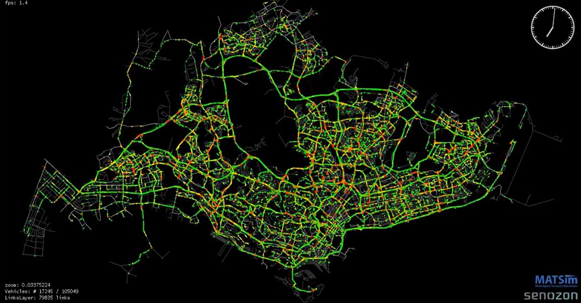
- Second, almost real-time adaptability will be studied with state-of-the-art agent-based simulations. MATSim frameworks will be extended so they can handle the unique challenges posed by the ‘city in flux’, with dynamically adaptive locations, mobility and infrastructure.
- Third, long-term adaptability of urban systems will be studied by exploring a wide ensemble of potential future scenarios and developing plans that can adapt according to how uncertainty unfolds.
The challenge will be to make this adaptability a governing principle across all scales of space and time, translated into an actual process for practitioners, rather than a vague vision of the future. Conceptually, we want to allow adaptability and identify pathways that, over time, unfold into desirable outcomes. While we need to be resilient to short-term variability and negative shocks, at the same time we must capitalise on abrupt transformations to leapfrog to unanticipated, desirable system states in the long-term. With this goal in mind, the project will bring tools, insights, methods and procedures that can provide decision-support for planning across relevant scales of time and space. We look to embed adaptability into the planning processes by engaging with planning agencies and understanding how they can make better use of the tools developed in the project. Therefore, simulation models and software tools will be developed in consultation with an expert panel of practitioners and policymakers, with the goal to improve resilience to short-term dynamics and reduce misalignment of provision and emerging demand in the long-term.
These learnings will be applied to a study of infrastructure corridors and urban development across intercity, city-wide and local scales in both Alpine and Southeast Asian contexts, with Zurich and Singapore as the main hubs under study. The project is funded by the Future Cities Laboratory (FCL Global) programme at the Singapore-ETH Centre (SEC).
FCL Global Website:
